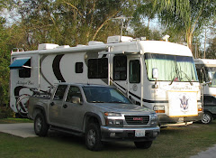

After making it to Torrey, UT, we set up camp, ate lunch, & headed to Capitol Reef National Park’s Visitor Center for requisite video & info. Where we discovered the surrounding 200 acres around the Visitor Center was known as Fruita, & up ten Mormon families planted & harvested fruit & nut trees for close to a century. Eventually the remoteness & constant threat of flash floods discouraged most families & they left. Even though the remaining orchards are not “natural” to the environment, the Park Service maintains them as they are of historical value. In fact for a nominal fee you can harvest whatever is in season, so we picked some apples. Finally we headed to Loa, UT, for groceries & to visit the National Forest office.


Thursday morning it was back to the park for a full day of exploring. First stops were to view Native American petroglyphs & Fruita School, a one room school house use until 1941. Then we visited the Gifford Homestead where generations of Giffords lived until they sold out to the Park Service in 1969. The original house has been restored & contains period furniture along with displays of life at Fruita. In addition there is a small store in the house that sales “period” items handcrafted by Mormons today based on authentic details, along with bakery items centered on the fruits & nuts grown at Fruita.
Then we commenced driving the park’s dead end scenic drive; first we drove to the very end so we could then take a dirt road into Capitol Gorge. When we came to the end of the dirt road, we hiked for about an hour further into the gorge where we saw more petroglyphs & a portion of the gorge wall where early day pioneers carved their names into the rock. We finished the day by backtracking to the RV, stopping at all the scenic overlooks we had passed-by on the way in, & doing a few more short hikes.


http://www.nps.gov/care/index.htm
Friday was an all day offroad drive on the Burr Trail, followed by Hells Backbone before completing the circle back in Torrey. We started the drive on the east side of the National Park by driving almost due south on Notom/Bullfrog Rd thru BLM land. This road is in the bottom of what is called the Waterpocket Fold, this is North America’s largest monocline & is the geographic event that created Capitol Reef. Views of the Fold in the park don’t do it justice because you only see small portions of it. The Fold runs basically north to south for over a hundred miles & you can only see long stretches of it from the Notom/Bullfrog Rd or from an airplane. Then we headed west on the Burr Trail (amazingly this was a cattle trail created by Mr Burr!) where we re-entered the National Park & soon encounter the infamous Burr Switchbacks. As we continued westward we left the Park for the Grand Staircase-Escalante National Monument (the first national monument under BLM management). Supposedly the Grand Staircase-Escalante area was the last place in continental USA to be mapped. After 86 miles & two hours we arrived in Boulder on SR 12 for a brown bag lunch break.


http://www.blm.gov/ut/st/en/fo/grand_staircase-escalante.html
After recovering from the first part of the drive, we then headed to the Hells Backbone Rd (aka the Poison Rd – one drop & your dead) in the Dixie National Forest. This road was built by the CCC in 1933 to shorten the distance between Boulder & Escalante, UT. We stopped at the one lane bridge at Death Hollow for photos. We also discovered a small house called the “Guard Station at Cowpuncher”. Guard stations were set up by the Forest Station to be one day’s horse ride apart for their Rangers. With the improvement in their dirt roads & 4-wheel drive, they are no longer needed; but now they are being preserved & are available for rent. Usually they don’t have electricity, but thanks to propane they do have hot water & indoor cooking equipment. At the end of our drive we even encountered modern day cowboys moving cattle down the road.


After resting a little back at the RV, we headed into Torrey for a walkabout (all 3 stores); & great hamburgers at Slackers, top 10 rated in Utah (Dan had to try fried green beans & pumpkin shake, both very good).

http://www.fs.usda.gov/main/dixie/home
Capitol Reef National Park is another jewel in the National Park Service system; but to really to understand the Waterpocket Fold & get “good” view of it, we recommend taking the time to drive the Notom/Bullfrog Rd. Unfortunately, there were no Ranger led activities that we have come to expect at every National Park.


No comments:
Post a Comment