


Early Sunday morning, Mother’s Day, we headed to Anacortes to catch the first WA State Ferry to Orcas Island, part of the San Juan Islands. Before we got started, there was a sinking realization that we had made the RV reservations at the wrong RV park, on the wrong island! We won’t bore you with the details, other than to say it was mostly Dan’s fault. At the last minute he realized that we had made a reservation at a RV park on San Juan Island, but we really wanted to be at a RV park on Orcas Island. If all things were equal, we would have just went to the park on San Juan; but that would have meant a more expensive ferry ride & the park on San Juan Island cost more per day than the one on Orcas. So we decided to head to Orcas without a reservation & “eat” the $60 non-refundable reservation fee.
The San Juan Islands are located in the Salish Sea between the mainland of Washington & Canada’s Vancouver Island. There are more than 700 islands in the archipelago, 172 of which are named, & over 300 of which are only above water at low tide. Since they lay in the rainshadow of the Olympic Mountains, they usually have more sunshine & less rain than the mainland. There are only four islands serviced by the Washington State Ferry System (ie that you can reach by RV/car) – Orcas (the biggest), San Juan (most people), Lopez (most rural), & Shaw (least people & least visited). The ferries only leave from Anacortes, WA, on what they call the “westbound” route; but since the four islands are sort of arranged in a circle & every run doesn’t stop at each of the four islands, you really have to be careful reading the schedule & picking a departure! For example, if we had stuck with our original reservation on San Juan rather than going to Orcas, we would have had to wait for another two hours for a boat going to San Juan Island.


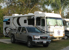
 To complicate things further the fare is not only based on the length of the route, but based on the length of your vehicle. So to save money we boarded the ferry in separate vehicles. After an extremely scenic ferry ride we arrived at Orcas Island & headed to West Beach Resort & RV Park. Not having a reservation was not a problem. In fact we had to decide between a several 20 amp sites with a view of the water, or several 30 amp sites with no view. We opted for a view site. End result, is that the money saved on the ferry ride & the camping fee, means we will save money overall even with the loss of $60.
 http://www.westbeachresort.com/
After setting up camp we headed to Moran State Park, with a stop in the village of Eastsound for lunch at Vern’s Lounge. After lunch we completed our drive to Moran State Park. This park is a special place for Dan, not only because his family & other relatives camped here on occasion; but also because Dan was part of the Youth Development & Conservation Corps (YDCC) for two months in 1969 working at in this very park. Historical records state - “Created in 1961 by the Washington State Legislature, the Youth Development and Conservation Corps (YDCC) affords youth and young men aged 14-21 employment opportunities in conservation programs that entail developing, improving, and maintaining natural and artificial recreation areas for the general public. It is designed to help young people--regardless of income--learn vocational and work skills, develop good work habits, cultivate a sense of responsibility and contribution to society, improve participants' physical and moral well-being, and promote an understanding and appreciation of nature. YDCC enrollees work as crew members under a YDCC supervisor; they receive $25 a week (40 hours) plus free room and board at a resident camp.”
What is not stated in the records is that half the participants were usually what were considered juvenile delinquents (ie usually from the inner city & had had run-ins with the law), & the other half of the participants were supposedly fine, upstanding youths (ie from the suburbs, usually white, & had never been caught by the law). The theory was that hard work combined with the example of the good kids would encourage the delinquents to improve their behavior! NOT!!! Let’s just say that the theory was seriously flawed. Although Dan was what would be considered a geek nowadays, & was all of 125 pounds at 6 feet, he eventually established himself among the others, eventually receiving a “raise” to $30 a week & at times being placed in charge of smaller work parties. Why? Because, almost all of the delinquents & most of the suburban kids had never been in the great outdoors like Dan. Not to say Dan was a survivalist or even a boy scout, but he knew enough to recognize “stinging” plants (ie nettles); recognize edible plants (salmon berries, black berries, oregon grapes); didn’t freak out about seeing deer, raccoons, skunks, etc; knew how to read a map & follow a trail without getting lost; & had actually used things like scythes, bow saws, shears, axes, roto-tiller, & chainsaw, not to mention pick axes, hoes & shovels. Looking back, some of the escapades of the YDCC youths were definitely not in keeping with the “ideals” of the program! But as they say – what happened in the YDCC, stays in the YDCC.
After a quick drive through the park & its campgrounds, we drove up to top of Mount Constitution. At the top is a stone lookout tower built by the CCC that has great views of Mt Baker; the Coastal Mountains of BC; Bellingham, WA; & various islands. On a really clear day you can even see Mt Rainer. We then completed our drive through the park & checked out the very small resort of Doe Bay, before returning to the RV.


http://www.parks.wa.gov/parks/?selectedpark=Moran
http://www.doebay.com/
Monday morning Corrie decided to dig for clams (one of her favorite foods) on the private beach that is part of the resort we are staying at. Although it was good low tide, the pickings were slim. We did get enough Sand Clams to boil up as an appetizer. We then visited Orcas Island Pottery, one of the oldest in the Pacific NW, with 60 years on Orcas Island. Although they have a shop in Eastsound, we visited their compound overlooking Presidents Channel where they display their numerous creations on the lawn or nailed to cabin walls.


http://www.orcasislandpottery.com/
Then it was off to the villages of Deer Harbor & Orcas Village (location of the ferry terminal) for some general sightseeing. To return to the RV Dan decided to take a dirt road he noticed on the map called Dolphin Bay Road. The road was in good condition & was very scenic. We were surprised to run into a flagman in the middle of nowhere, where they were burying power lines. When the workers noticed our Texas license plates, they let out a “yee haw”!

 Tuesday, day 3 in the San Juan Islands, we decided to take a ferry to Lopez Island. Remember the discussion of ferry schedules? Well it really gets complicated when you go between islands! Not only to you have the westbound schedule out of Anacortes; but you have the eastbound schedule of another boat returning to Anacortes; & a third boat that circles the four islands on an inter-island route. End result is you really have to read the schedule carefully or you can end up waiting hours for a twenty minute ferry ride; & in some cases it is faster to go in the opposite direction then you want to travel, get off one boat & board another.
Having figured out the schedule we boarded the inter-island ferry, EVERGREEN STATE, for the 30 minute ride to Lopez Island. The first thing we noticed is that since the boat is constantly traveling between the same four islands, the crew knows all the locals & everyone catches up on the latest in their lives during the short trip. Also, there are several jigsaw puzzles on the tables that are worked on by the passengers off-and-on during the short trips. Lopez is the most rural of the “developed” islands & is known as the friendliest island (everyone in oncoming cars waves at you, we soon learned to wave back).
After disembarking the ferry we headed to Spencer Spit State Park, where explored the beach & tide pools. From there it was off to Agate Beach for more exploration, where the home owners proudly proclaim it is a “no spandex zone”. Further down the road was the abandoned village of Richardson which was an important fishing vessel port with two canneries around 1920, but now all that remains is the abandoned fuel dock. While there we observed an otter in the water eating what appeared to be an eel, & a blue heron catching fish in the shallows. We then finished the day by driving to Lopez village, via Shark Reef Park, for lunch at the Islander Resort. As expected we boarded the very same inter-island ferry, EVERGREEN STATE, & Corrie’s puzzle still needed finishing.


 http://www.parks.wa.gov/parks/?selectedpark=Spencer%20Spit
Wednesday morning we again headed to the ferry terminal to go to San Juan Island. Right as we got to the terminal Dan realized he had forgot the camera! We made a U-turn back to the RV, got the camera, & barely made the boat (in fact, if it had sailed on time, we would have missed it). Once again the ferry was the EVERGREEN STATE, but someone had “taken” Corrie’s jigsaw puzzle, so she had to work on another. We disembarked at Friday Harbor & headed to the “American Camp” at San Juan Island National Historical Park. This historical park is comprised of the American Camp & the English Camp, & dedicated to the Pig War.
For those of you don’t remember the Pig War from history class, here is a summary:
---An international convention in 1818 recognizes the USA rights to all land east of the Stony Mountains (aka Rockies) below 49 degrees latitude. But England & the USA will have equal rights to all northwest lands west of the Stony Mountains.
---President Polk states in 1845: “54-40 or fight”, & gives one year notice on canceling the 1818 convention.
---In 1846 the Treaty of Oregon is signed setting the boundary at 49 degrees latitude & giving the entire island of Vancouver to England. The treaty also states that the ownership of the islands, now called the San Juan Islands, will be determined by a line drawn down the middle of the Straits. Unfortunately the Treaty does not name the Straits to be used, & there were two Straits (Rosario Strait & Haro Strait).
---The “ownership” of the islands remains in dispute, & citizens from both countries set up homesteads on the various islands.
---In 1859 Lyman Cutlar, an American, kills a trespassing pig owned by the Hudson Bay Company on San Juan Island. Hudson Bay supposedly threatens Cutlar with arrest. General Harney in Oregon sends troops to protect Americans. The Governor of British Columbia sends the Royal Navy & Marines to protect English interests. The US Army Commander, General Winfield Scott, is dispatched from DC to contain the situation & prevent war.
---An agreement is reached where starting in 1860 the English will have a permanent military presence at the north end of San Juan Island, & the USA will have permanent military presence at the south end of the island.
---In 1871 the question is submitted for arbitration to Kaiser Wilhelm I. The Kaiser rules the islands belong to the USA (ie he picks Haro Strait).
---The Royal Marines leave San Juan Island in November 1872.
The American Camp is located on an unique prairie eco system that the Park Service is trying to rid of non-native plants, non-native rabbits (introduced by the English) & non-native foxes (several of which we saw on our hike). The USA Army picked their site based on the ease of defending it & being able to bring their guns to bear on passing ships. The end result was a good choice strategically; but because it was a treeless prairie, the wind & weather were not the best. Two USA Army officers that served there went on to more famous exploits – Captain Pickett who led an ill fated charge at Gettysburg, & Lt Robert who wrote some book called “Rules of Order”.


http://www.parks.wa.gov/parks/?selectedpark=Lime%20Kiln%20Point
We then headed to the English Camp. Their camp was selected on the need to have a safe harbor for their naval vessels & to be less than one days sail from their navy base at Victoria, BC. To say their surroundings (& weather) were better than the Americans, is an understatement! They even had time to plant an English formal garden & fruit trees. Long story, short, is that the Brits & Yanks spent the next 12 years celebrating each others holidays, horse racing, competing in sports, & trying not to let the boredom get to them.
Then it was back to Friday Harbor for lunch at the Happy Clam & a walkabout in the largest town in the islands. One unique thing we observed, were taxi cabs with kayak racks on their roofs. Once again we boarded the EVERGREEN STATE back to Orcas Island. On the boat ride Dan caught up on some reading, while Corrie continued to work on her jigsaw puzzle.

Thursday, our last full day on Orcas, we had coffee on the beach. Then Dan & Gumbo took off to hike in Moran State Park. Their first hike was a little over two miles, around Cascade Lake. They then hiked a little under a mile to view Cascade Falls & Rustic Falls. Then Dan decided to drive again to the top of Mount Constitution to see if there was a better view of Mt Baker. Meanwhile, Corrie spent the day at the Resort just relaxing.


 Tomorrow it’s back to the mainland. Maybe next time we will make to Shaw Island?
Trivia – Who or what is Moran state park named after? Other than being the largest “town” in the islands, what is unique about the town of Friday Harbor? What does QTE in morse code mean? What is “French leave”?
The San Juan Islands are located in the Salish Sea between the mainland of Washington & Canada’s Vancouver Island. There are more than 700 islands in the archipelago, 172 of which are named, & over 300 of which are only above water at low tide. Since they lay in the rainshadow of the Olympic Mountains, they usually have more sunshine & less rain than the mainland. There are only four islands serviced by the Washington State Ferry System (ie that you can reach by RV/car) – Orcas (the biggest), San Juan (most people), Lopez (most rural), & Shaw (least people & least visited). The ferries only leave from Anacortes, WA, on what they call the “westbound” route; but since the four islands are sort of arranged in a circle & every run doesn’t stop at each of the four islands, you really have to be careful reading the schedule & picking a departure! For example, if we had stuck with our original reservation on San Juan rather than going to Orcas, we would have had to wait for another two hours for a boat going to San Juan Island.


 To complicate things further the fare is not only based on the length of the route, but based on the length of your vehicle. So to save money we boarded the ferry in separate vehicles. After an extremely scenic ferry ride we arrived at Orcas Island & headed to West Beach Resort & RV Park. Not having a reservation was not a problem. In fact we had to decide between a several 20 amp sites with a view of the water, or several 30 amp sites with no view. We opted for a view site. End result, is that the money saved on the ferry ride & the camping fee, means we will save money overall even with the loss of $60.
 http://www.westbeachresort.com/
After setting up camp we headed to Moran State Park, with a stop in the village of Eastsound for lunch at Vern’s Lounge. After lunch we completed our drive to Moran State Park. This park is a special place for Dan, not only because his family & other relatives camped here on occasion; but also because Dan was part of the Youth Development & Conservation Corps (YDCC) for two months in 1969 working at in this very park. Historical records state - “Created in 1961 by the Washington State Legislature, the Youth Development and Conservation Corps (YDCC) affords youth and young men aged 14-21 employment opportunities in conservation programs that entail developing, improving, and maintaining natural and artificial recreation areas for the general public. It is designed to help young people--regardless of income--learn vocational and work skills, develop good work habits, cultivate a sense of responsibility and contribution to society, improve participants' physical and moral well-being, and promote an understanding and appreciation of nature. YDCC enrollees work as crew members under a YDCC supervisor; they receive $25 a week (40 hours) plus free room and board at a resident camp.”
What is not stated in the records is that half the participants were usually what were considered juvenile delinquents (ie usually from the inner city & had had run-ins with the law), & the other half of the participants were supposedly fine, upstanding youths (ie from the suburbs, usually white, & had never been caught by the law). The theory was that hard work combined with the example of the good kids would encourage the delinquents to improve their behavior! NOT!!! Let’s just say that the theory was seriously flawed. Although Dan was what would be considered a geek nowadays, & was all of 125 pounds at 6 feet, he eventually established himself among the others, eventually receiving a “raise” to $30 a week & at times being placed in charge of smaller work parties. Why? Because, almost all of the delinquents & most of the suburban kids had never been in the great outdoors like Dan. Not to say Dan was a survivalist or even a boy scout, but he knew enough to recognize “stinging” plants (ie nettles); recognize edible plants (salmon berries, black berries, oregon grapes); didn’t freak out about seeing deer, raccoons, skunks, etc; knew how to read a map & follow a trail without getting lost; & had actually used things like scythes, bow saws, shears, axes, roto-tiller, & chainsaw, not to mention pick axes, hoes & shovels. Looking back, some of the escapades of the YDCC youths were definitely not in keeping with the “ideals” of the program! But as they say – what happened in the YDCC, stays in the YDCC.
After a quick drive through the park & its campgrounds, we drove up to top of Mount Constitution. At the top is a stone lookout tower built by the CCC that has great views of Mt Baker; the Coastal Mountains of BC; Bellingham, WA; & various islands. On a really clear day you can even see Mt Rainer. We then completed our drive through the park & checked out the very small resort of Doe Bay, before returning to the RV.


http://www.parks.wa.gov/parks/?selectedpark=Moran
http://www.doebay.com/
Monday morning Corrie decided to dig for clams (one of her favorite foods) on the private beach that is part of the resort we are staying at. Although it was good low tide, the pickings were slim. We did get enough Sand Clams to boil up as an appetizer. We then visited Orcas Island Pottery, one of the oldest in the Pacific NW, with 60 years on Orcas Island. Although they have a shop in Eastsound, we visited their compound overlooking Presidents Channel where they display their numerous creations on the lawn or nailed to cabin walls.


http://www.orcasislandpottery.com/
Then it was off to the villages of Deer Harbor & Orcas Village (location of the ferry terminal) for some general sightseeing. To return to the RV Dan decided to take a dirt road he noticed on the map called Dolphin Bay Road. The road was in good condition & was very scenic. We were surprised to run into a flagman in the middle of nowhere, where they were burying power lines. When the workers noticed our Texas license plates, they let out a “yee haw”!

 Tuesday, day 3 in the San Juan Islands, we decided to take a ferry to Lopez Island. Remember the discussion of ferry schedules? Well it really gets complicated when you go between islands! Not only to you have the westbound schedule out of Anacortes; but you have the eastbound schedule of another boat returning to Anacortes; & a third boat that circles the four islands on an inter-island route. End result is you really have to read the schedule carefully or you can end up waiting hours for a twenty minute ferry ride; & in some cases it is faster to go in the opposite direction then you want to travel, get off one boat & board another.
Having figured out the schedule we boarded the inter-island ferry, EVERGREEN STATE, for the 30 minute ride to Lopez Island. The first thing we noticed is that since the boat is constantly traveling between the same four islands, the crew knows all the locals & everyone catches up on the latest in their lives during the short trip. Also, there are several jigsaw puzzles on the tables that are worked on by the passengers off-and-on during the short trips. Lopez is the most rural of the “developed” islands & is known as the friendliest island (everyone in oncoming cars waves at you, we soon learned to wave back).

After disembarking the ferry we headed to Spencer Spit State Park, where explored the beach & tide pools. From there it was off to Agate Beach for more exploration, where the home owners proudly proclaim it is a “no spandex zone”. Further down the road was the abandoned village of Richardson which was an important fishing vessel port with two canneries around 1920, but now all that remains is the abandoned fuel dock. While there we observed an otter in the water eating what appeared to be an eel, & a blue heron catching fish in the shallows. We then finished the day by driving to Lopez village, via Shark Reef Park, for lunch at the Islander Resort. As expected we boarded the very same inter-island ferry, EVERGREEN STATE, & Corrie’s puzzle still needed finishing.


 http://www.parks.wa.gov/parks/?selectedpark=Spencer%20Spit
Wednesday morning we again headed to the ferry terminal to go to San Juan Island. Right as we got to the terminal Dan realized he had forgot the camera! We made a U-turn back to the RV, got the camera, & barely made the boat (in fact, if it had sailed on time, we would have missed it). Once again the ferry was the EVERGREEN STATE, but someone had “taken” Corrie’s jigsaw puzzle, so she had to work on another. We disembarked at Friday Harbor & headed to the “American Camp” at San Juan Island National Historical Park. This historical park is comprised of the American Camp & the English Camp, & dedicated to the Pig War.

For those of you don’t remember the Pig War from history class, here is a summary:
---An international convention in 1818 recognizes the USA rights to all land east of the Stony Mountains (aka Rockies) below 49 degrees latitude. But England & the USA will have equal rights to all northwest lands west of the Stony Mountains.
---President Polk states in 1845: “54-40 or fight”, & gives one year notice on canceling the 1818 convention.
---In 1846 the Treaty of Oregon is signed setting the boundary at 49 degrees latitude & giving the entire island of Vancouver to England. The treaty also states that the ownership of the islands, now called the San Juan Islands, will be determined by a line drawn down the middle of the Straits. Unfortunately the Treaty does not name the Straits to be used, & there were two Straits (Rosario Strait & Haro Strait).
---The “ownership” of the islands remains in dispute, & citizens from both countries set up homesteads on the various islands.
---In 1859 Lyman Cutlar, an American, kills a trespassing pig owned by the Hudson Bay Company on San Juan Island. Hudson Bay supposedly threatens Cutlar with arrest. General Harney in Oregon sends troops to protect Americans. The Governor of British Columbia sends the Royal Navy & Marines to protect English interests. The US Army Commander, General Winfield Scott, is dispatched from DC to contain the situation & prevent war.
---An agreement is reached where starting in 1860 the English will have a permanent military presence at the north end of San Juan Island, & the USA will have permanent military presence at the south end of the island.
---In 1871 the question is submitted for arbitration to Kaiser Wilhelm I. The Kaiser rules the islands belong to the USA (ie he picks Haro Strait).
---The Royal Marines leave San Juan Island in November 1872.
The American Camp is located on an unique prairie eco system that the Park Service is trying to rid of non-native plants, non-native rabbits (introduced by the English) & non-native foxes (several of which we saw on our hike). The USA Army picked their site based on the ease of defending it & being able to bring their guns to bear on passing ships. The end result was a good choice strategically; but because it was a treeless prairie, the wind & weather were not the best. Two USA Army officers that served there went on to more famous exploits – Captain Pickett who led an ill fated charge at Gettysburg, & Lt Robert who wrote some book called “Rules of Order”.


And as usually occurred when the military set up a base, a town (or in this case a village) soon followed. A written record from the 1862 noted about Old San Juan Village that - “about 20 houses: one of them is occupied by a store keeper who keeps an exceedingly limited supply of goods; five or six are ‘rum mills’, and the balance are vacant. The population of the place numbers about 30 or 40...white men, Chinamen and Indians. Whiskey drinking seems to be the principal occupation.” Once the USA Army left in 1872, the village soon disappeared.
www.nps.gov/sajh
After spending several hours at the American Camp we headed to Lime Kiln State Park (aka Whale Watch Park). This spot is supposed to be the best for catching offshore glimpses of whales & dolphins. But right now is still early in the season, & we did not see any. But we still enjoyed hiking along the cliffs to the lighthouse.


http://www.parks.wa.gov/parks/?selectedpark=Lime%20Kiln%20Point
We then headed to the English Camp. Their camp was selected on the need to have a safe harbor for their naval vessels & to be less than one days sail from their navy base at Victoria, BC. To say their surroundings (& weather) were better than the Americans, is an understatement! They even had time to plant an English formal garden & fruit trees. Long story, short, is that the Brits & Yanks spent the next 12 years celebrating each others holidays, horse racing, competing in sports, & trying not to let the boredom get to them.
Then it was back to Friday Harbor for lunch at the Happy Clam & a walkabout in the largest town in the islands. One unique thing we observed, were taxi cabs with kayak racks on their roofs. Once again we boarded the EVERGREEN STATE back to Orcas Island. On the boat ride Dan caught up on some reading, while Corrie continued to work on her jigsaw puzzle.


Thursday, our last full day on Orcas, we had coffee on the beach. Then Dan & Gumbo took off to hike in Moran State Park. Their first hike was a little over two miles, around Cascade Lake. They then hiked a little under a mile to view Cascade Falls & Rustic Falls. Then Dan decided to drive again to the top of Mount Constitution to see if there was a better view of Mt Baker. Meanwhile, Corrie spent the day at the Resort just relaxing.


 Tomorrow it’s back to the mainland. Maybe next time we will make to Shaw Island?
Trivia – Who or what is Moran state park named after? Other than being the largest “town” in the islands, what is unique about the town of Friday Harbor? What does QTE in morse code mean? What is “French leave”?


2 comments:
We are interested in following your RV adventures. Hope you don't mind! We look forward to reading your archives too. :)
thanks for the feedback & feel free to follow our adventures at anytime. maybe your BLOG will be easier to maintain than ours; but it makes worthwhile when you discover someone is actually reading it. - corrie & dan
Post a Comment